|
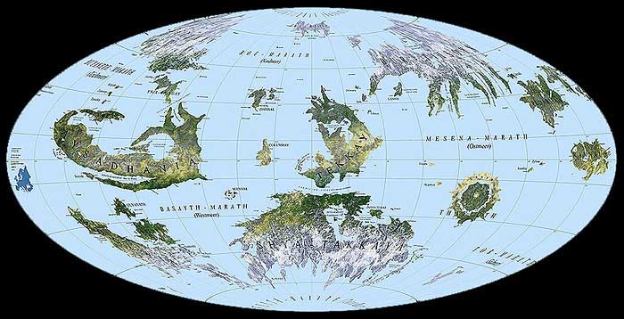
Please click on the area on the map you like to go to.
|
|||
|
If you click on an area, the smallest map available will be opened. You may select more detailed maps on the following pages.
|
|||
|
Please notice: island are included depending on their size. Single islands close together are only shown as archipelagos. Furthermore, this search is resticted by the size of the maps available now. This means, depending on the scale of the map, only a small part of the known lenntayn will appear on it. In addition to that, places, communities and breeding areas of Phulgay, Tsippin and Koolay are only included if they are of remarkable cultural importance. The map on this page is based on the area proportional Hammer projection, the linked maps are projected as equidistant cylindrical projections (plane charts).
|
||
Back to the Ayganyan Atlas
Back to the Ayganyan Project Index