|
Keloeth
|
||
|
Ika'l'oogh
|
Ethal-ugaoe
|
Kejalat
|
|
(Koolayal)
|
(Phulgayn)
|
(Tsippin)
|
|
Miree darapuyon laonay gituyan doia mibapuyon epil derin muj io sen-ilin ciimin (The higher the imaginations live the richer is the way that leads to them.) |
|||||||||||||||||||
|
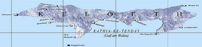
Keloeth Data
|
Keloeth General Map
1000 km |
||||||||||||||||||
|
Further Information
On the virtual Retariayn-ke-Rot journey you can visit the The Landmark panoramic journey takes you to a 360 degree surround view of the Gate of the North near Misoyth. On the virtual Jiimay-ke--Namdighoy-Tia journey you can take a look at the "Ruins of the Temple of Tooejeth" [Byadoalh-Tooajeth] near Ceeronuy . (the second link is not active yet) |
Keloeth on the Ayganyan Map
(Please click to open the Ayganyan map) 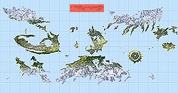 |
||||||||||||||||||
|
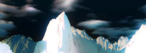
Picture Information
The peak of Kye'akyath in the high mountains of Morkahr. |
|||||||||||||||||||