|
Norelaygia
|
||
|
Oolai
|
Ae-muaal
|
Iji-moo
|
|
(Koolayal)
|
(Phulgayn)
|
(Tsippin)
|
|
Angitarh
|
||
|
Gin'og bara
|
Aoarae
|
Ghadnari
|
|
(Koolayal)
|
(Phulgayn)
|
(Tsippin)
|
|
Uteiay seghama siipin maai kirio-fhela borin (The souls dance together when new life appears.) |
||||||||||||||||||||||||||||||||||||||||
|
Norelaygia Data
Angitarh Data
|
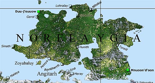
Norelaygia General Map
This map provides more detailed information if you click its hotspots. Please move the mouse pointer over the image to select an interactive region.
1000 km |
|||||||||||||||||||||||||||||||||||||||
|
Further Information
The term "Norelaygia" derives from the traditional vocabulary of the Serganyay. It can be translated as "The Land of the Alterables." In fact Norelaygia can be seen as a stronghold of the Phulgay, whose old breeding areas have assumed the shapes of huge amorphous structures. The biggest ones you find in the southern Duu-j'euuow as well as in the south eastern Mnuoon'd'oon. In addition to that the tremendous south eatern marshesare are often being used by the Phulgay to hold their Eternal Meeting. |
Norelaygia on the Ayganyan Map
(Please click to open the Ayganyan map) 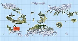 |
|||||||||||||||||||||||||||||||||||||||
|
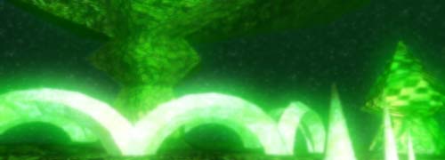
Picture Information
Huge Phulgay mother-structure Click the links for more information on fhe Phulgay and their mother-structures. |
||||||||||||||||||||||||||||||||||||||||